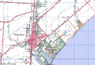
CanMatrix consists of scanned topographic maps of Canada at the 1:50 000 and 1:250 000 scales. Since CanMatrix maps are georeferenced, they can be used as a background for various applications, such as: ArcGIS, MapInfo, AutoCad or Global Position Systems (GPS)

Access
CanMatrix is available for download at:
Georeferenced digital topographic maps:
Geogratis
Print ready digital topographic maps:
Geogratis
Additional Information
| Title | CanMatrix |
| Author | Minister of Natural Resources, Canada |
| Date | Various |
| Language | English & French |
| Format | GeoTIFF {.tif} |
| Scale | 1:50 000 & 1:250 000 |
| Projection | UTM |
| Datum | NAD83 |
| Resolution | 300 dpi |
| Access Tips |
|
| Licence | Available to the general public |
| Additional Documentation |
|
| Citation (sample) | Natural Resources Canada. [computer file]. CanMatrix, 1:50 000, Laurentides, Quebec. sheet 31H/13, edition 12. Ottawa: Natural Resources Canada, Geomatics Canada, 1995. |
