- McGill users only
- Open access resource
- Free resource
- In-library-use only
- Catalogue record
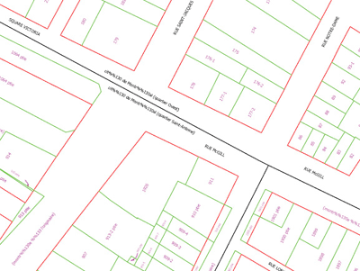
The Montreal Cadastral Plans are detailed large scale maps (1:1 000) delinating the property boundaries of the City of Montreal. The geographic area covered includes the former limits of the city (pre-2001). Each file covers 0.7 square kilometers. Layers include: property lines and cadastral numbers. The data is available in AutoCAD format (.dwg), projected in Modified Transverse Mercator, Zone 8 NAD83, using meters as the base unit of measurement.
Metadata
| Title | Montreal Cadastral Plans 1:1 000 - Plans cadastre de Montréal 1/1000 |
| Author | City of Montreal |
| Date | 1999 |
| Language | French |
| Format | AutoCAD (.dwg) |
| Scale | 1:1 000 |
| Projection | Modified Transverse Mercator. Zone 8. |
| Datum | NAD83 |
| Licence | Restricted to McGill users |
| Index Map | Montreal Cadastral Plans Index Map of the data files available. |
| Documentation | Liste des plages d'information pour la cartographie pour la carte cadastrale (French) contains a detailed description of the layers found in each Montreal Cadastral Plan file. |
| Access | Download [restricted to McGill students, faculty and staff] |
| Citation | Plans cadastre (Montréal) 1/1000 Map Number. [computer file]. 1:1 000, Montréal: Ville de Montréal year. |
Data
Index map | Supplementary information for intrepreting the data
31H05
- 31H05-010-3008
- 31H05-010-3009
- 31H05-010-3010
- 31H05-010-3033
- 31H05-010-3108
- 31H05-010-3109
- 31H05-010-3110
- 31H05-010-3132
- 31H05-010-3133
- 31H05-010-3208
- 31H05-010-3209
- 31H05-010-3210
- 31H05-010-3211
- 31H05-010-3230
- 31H05-010-3232
- 31H05-010-3233
- 31H05-010-3310
- 31H05-010-3311
- 31H05-010-3312
- 31H05-010-3329
- 31H05-010-3330
- 31H05-010-3331
- 31H05-010-3332
- 31H05-010-3333
- 31H05-010-3334
- 31H05-010-3411
- 31H05-010-3428
- 31H05-010-3429
- 31H05-010-3430
- 31H05-010-3431
- 31H05-010-3432
- 31H05-010-3433
- 31H05-010-3434
- 31H05-010-3528
- 31H05-010-3529
- 31H05-010-3530
- 31H05-010-3531
- 31H05-010-3532
- 31H05-010-3533
- 31H05-010-3534
- 31H05-010-3535
- 31H05-010-3628
- 31H05-010-3629
- 31H05-010-3630
- 31H05-010-3631
- 31H05-010-3632
- 31H05-010-3633
- 31H05-010-3634
- 31H05-010-3634
- 31H05-010-3635
- 31H05-010-3635
- 31H05-010-3636
- 31H05-010-3637
- 31H05-010-3727
- 31H05-010-3728
- 31H05-010-3729
- 31H05-010-3730
- 31H05-010-3731
- 31H05-010-3732
- 31H05-010-3733
- 31H05-010-3734
- 31H05-010-3734
- 31H05-010-3735
- 31H05-010-3735
- 31H05-010-3736
- 31H05-010-3737
- 31H05-010-3738
- 31H05-010-3826
- 31H05-010-3827
- 31H05-010-3828
- 31H05-010-3829
- 31H05-010-3830
- 31H05-010-3831
- 31H05-010-3832
- 31H05-010-3833
- 31H05-010-3834
- 31H05-010-3835
- 31H05-010-3835
- 31H05-010-3836
- 31H05-010-3836
- 31H05-010-3837
- 31H05-010-3838
- 31H05-010-3926
- 31H05-010-3927
- 31H05-010-3928
- 31H05-010-3929
- 31H05-010-3930
- 31H05-010-3931
- 31H05-010-3932
- 31H05-010-3933
- 31H05-010-3934
- 31H05-010-3935
- 31H05-010-3935
- 31H05-010-3936
- 31H05-010-3936
- 31H05-010-3937
- 31H05-010-3938
- 31H05-010-4027
- 31H05-010-4028
- 31H05-010-4029
- 31H05-010-4030
- 31H05-010-4031
- 31H05-010-4032
- 31H05-010-4033
- 31H05-010-4034
- 31H05-010-4035
- 31H05-010-4036
- 31H05-010-4037
- 31H05-010-4038
- 31H05-010-4039
31H11
31H12
- 31H12-010-083
- 31H12-010-0128
- 31H12-010-0129
- 31H12-010-0130
- 31H12-010-0131
- 31H12-010-0132
- 31H12-010-0133
- 31H12-010-0134
- 31H12-010-0135
- 31H12-010-0136
- 31H12-010-0137
- 31H12-010-0138
- 31H12-010-0139
- 31H12-010-0219
- 31H12-010-0220
- 31H12-010-0221
- 31H12-010-0229
- 31H12-010-0230
- 31H12-010-0231
- 31H12-010-0232
- 31H12-010-0233
- 31H12-010-0234
- 31H12-010-0235
- 31H12-010-0236
- 31H12-010-0237
- 31H12-010-0238
- 31H12-010-0239
- 31H12-010-0320
- 31H12-010-0321
- 31H12-010-0322
- 31H12-010-0329
- 31H12-010-0330
- 31H12-010-0331
- 31H12-010-0333
- 31H12-010-0334
- 31H12-010-0335
- 31H12-010-0336
- 31H12-010-0337
- 31H12-010-0338
- 31H12-010-0339
- 31H12-010-0420
- 31H12-010-0421
- 31H12-010-0422
- 31H12-010-0423
- 31H12-010-0424
- 31H12-010-0430
- 31H12-010-0431
- 31H12-010-0432
- 31H12-010-0433
- 31H12-010-0434
- 31H12-010-0435
- 31H12-010-0436
- 31H12-010-0437
- 31H12-010-0438
- 31H12-010-0521
- 31H12-010-0522
- 31H12-010-0523
- 31H12-010-0524
- 31H12-010-0525
- 31H12-010-0526
- 31H12-010-0527
- 31H12-010-0528
- 31H12-010-0529
- 31H12-010-0530
- 31H12-010-0531
- 31H12-010-0532
- 31H12-010-0533
- 31H12-010-0534
- 31H12-010-0535
- 31H12-010-0536
- 31H12-010-0537
- 31H12-010-0538
- 31H12-010-0622
- 31H12-010-0623
- 31H12-010-0624
- 31H12-010-0625
- 31H12-010-0626
- 31H12-010-0627
- 31H12-010-0628
- 31H12-010-0629
- 31H12-010-0630
- 31H12-010-0631
- 31H12-010-0632
- 31H12-010-0633
- 31H12-010-0634
- 31H12-010-0635
- 31H12-010-0636
- 31H12-010-0637
- 31H12-010-0638
- 31H12-010-0723
- 31H12-010-0724
- 31H12-010-0725
- 31H12-010-0726
- 31H12-010-0727
- 31H12-010-0728
- 31H12-010-0729
- 31H12-010-0730
- 31H12-010-0731
- 31H12-010-0732
- 31H12-010-0733
- 31H12-010-0734
- 31H12-010-0735
- 31H12-010-0736
- 31H12-010-0737
- 31H12-010-0738
- 31H12-010-0739
- 31H12-010-0824
- 31H12-010-0825
- 31H12-010-0826
- 31H12-010-0827
- 31H12-010-0828
- 31H12-010-0829
- 31H12-010-0830
- 31H12-010-0831
- 31H12-010-0832
- 31H12-010-0833
- 31H12-010-0834
- 31H12-010-0835
- 31H12-010-0836
- 31H12-010-0837
- 31H12-010-0838
- 31H12-010-0839
- 31H12-010-0926
- 31H12-010-0927
- 31H12-010-0928
- 31H12-010-0929
- 31H12-010-0930
- 31H12-010-0931
- 31H12-010-0932
- 31H12-010-0933
- 31H12-010-0934
- 31H12-010-0935
- 31H12-010-0936
- 31H12-010-0937
- 31H12-010-0938
- 31H12-010-0939
- 31H12-010-1027
- 31H12-010-1028
- 31H12-010-1029
- 31H12-010-1030
- 31H12-010-1031
- 31H12-010-1032
- 31H12-010-1033
- 31H12-010-1034
- 31H12-010-1035
- 31H12-010-1036
- 31H12-010-1037
- 31H12-010-1038
- 31H12-010-1039
- 31H12-010-1127
- 31H12-010-1128
- 31H12-010-1129
- 31H12-010-1130
- 31H12-010-1131
- 31H12-010-1132
- 31H12-010-1133
- 31H12-010-1134
- 31H12-010-1135
- 31H12-010-1136
- 31H12-010-1137
- 31H12-010-1138
- 31H12-010-1139
- 31H12-010-1227
- 31H12-010-1228
- 31H12-010-1229
- 31H12-010-1230
- 31H12-010-1231
- 31H12-010-1232
- 31H12-010-1233
- 31H12-010-1234
- 31H12-010-1235
- 31H12-010-1236
- 31H12-010-1237
- 31H12-010-1238
- 31H12-010-1239
- 31H12-010-1240
- 31H12-010-1327
- 31H12-010-1328
- 31H12-010-1329
- 31H12-010-1330
- 31H12-010-1331
- 31H12-010-1332
- 31H12-010-1334
- 31H12-010-1335
- 31H12-010-1336
- 31H12-010-1337
- 31H12-010-1338
- 31H12-010-1339
- 31H12-010-1340
- 31H12-010-1428
- 31H12-010-1429
- 31H12-010-1430
- 31H12-010-1431
- 31H12-010-1435
- 31H12-010-1436
- 31H12-010-1437
- 31H12-010-1438
- 31H12-010-1439
- 31H12-010-1440
- 31H12-010-1535
- 31H12-010-1536
- 31H12-010-1537
- 31H12-010-1538
- 31H12-010-1539
- 31H12-010-1540
- 31H12-010-1635
- 31H12-010-1636
- 31H12-010-1637
- 31H12-010-1638
- 31H12-010-1639
- 31H12-010-1640
- 31H12-010-1737
- 31H12-010-1738
- 31H12-010-1739
- 31H12-010-1740
- 31H12-010-1837
- 31H12-010-1838
- 31H12-010-1839
- 31H12-010-1840
- 31H12-010-1932
- 31H12-010-1933
- 31H12-010-1937
- 31H12-010-1938
- 31H12-010-1939
- 31H12-010-2031
- 31H12-010-2032
- 31H12-010-2033
- 31H12-010-2034
- 31H12-010-2131
- 31H12-010-2132
- 31H12-010-2133
- 31H12-010-2134
- 31H12-010-2135
- 31H12-010-2231
- 31H12-010-2232
- 31H12-010-2233
- 31H12-010-2234
- 31H12-010-2235
- 31H12-010-2239
- 31H12-010-2240
- 31H12-010-2331
- 31H12-010-2332
- 31H12-010-2333
- 31H12-010-2334
- 31H12-010-2335
- 31H12-010-2336
- 31H12-010-2338
- 31H12-010-2339
- 31H12-010-2340
- 31H12-010-2432
- 31H12-010-2433
- 31H12-010-2434
- 31H12-010-2435
- 31H12-010-2436
- 31H12-010-2437
- 31H12-010-2438
- 31H12-010-2439
- 31H12-010-2440
- 31H12-010-2533
- 31H12-010-2534
- 31H12-010-2535
- 31H12-010-2536
- 31H12-010-2537
- 31H12-010-2538
- 31H12-010-2539
- 31H12-010-2540
- 31H12-010-2634
- 31H12-010-2635
- 31H12-010-2636
- 31H12-010-2637
- 31H12-010-2638
- 31H12-010-2639
- 31H12-010-2640
- 31H12-010-2735
- 31H12-010-2736
- 31H12-010-2737
- 31H12-010-2738
- 31H12-010-2739
- 31H12-010-2740
- 31H12-010-2836
- 31H12-010-2837
- 31H12-010-2838
- 31H12-010-2839
- 31H12-010-2840
- 31H12-010-2937
- 31H12-010-2938
- 31H12-010-2939
- 31H12-010-2940
- 31H12-010-3038
- 31H12-010-3039
- 31H12-010-3040
- 31H12-010-3138
- 31H12-010-3139
- 31H12-010-3140
- 31H12-010-3201
- 31H12-010-3202
- 31H12-010-3239
- 31H12-010-3240
