Research overview

We miss Penguin in the Arctic
Our primary mission revolves around unravelling the enigmatic mysteries of the Arctic. We leverage state-of-the-art remote sensing techniques and cutting-edge methodologies specific to sea ice geophysics to achieve this. These sophisticated tools enable us to delve into the intricate interplay among the atmosphere, sea ice, and ocean properties across various critical scales. At the core of our pursuits lies a profound desire to comprehend the ever-evolving dynamics of snow-covered sea ice within our changing climate. We aim to decode this evolution's profound implications on retrieving vital snow/sea ice geophysical parameters. Employing a diverse arsenal that includes low-frequency surface-based radar systems, satellite-based technologies, and a fusion of geostatistical and machine-learning methodologies, we investigate the complex phenomena of Arctic sea ice. Our research spans from the nuanced local intricacies to the expansive pan-Arctic landscape. Through the marriage of technology, collaboration, and an insatiable curiosity, we aim to decipher the complexities of this environment and comprehend its far-reaching implications in our constantly evolving climate.
Research icescape
The rapid changes in the Arctic environment necessitate a concerted effort to advance the collection, accuracy, and delivery of sea ice information. This involves technology development, community engagement, and international collaboration to address the unique challenges posed by the evolving Arctic icescape.
Our goal is to advance critical information retrieval on snow-covered sea ice in the Arctic.
To achieve this, our research group addresses the following research questions:
- What is the electro-thermo-physical dependence of radar interactions from different snow-covered sea ice classes?
- How do multi-frequency radar signals vary under diverse sea ice thermo-/dynamic conditions?
- How can we improve sea ice property retrieval from SAR imagery?
- How can we disseminate critical sea ice information to northern stakeholders?
Research themes
Dr. Mahmud’s lab focuses on following HQP-centered research themes to answer the above questions, advancing toward the long-term goal.

Sea ice type mapping
Robust and reliable mapping of sea ice properties, such as type and roughness, are required for operational and environmental applications in the new sea ice regime. The presence and distribution of different sea ice types are pivotal in understanding Arctic climate change. Arctic sea ice type is one of the most widely available parameters, yet it is a complex variable to retrieve. Additionally, surface roughness is crucial in the Arctic and displays a discernible pattern across various classifications of sea ice, indicating vital parameters, including ice thickness, divergence, and convergence. Therefore, our research group is invested in accurately assessing and retrieving sea ice dynamics, thermodynamics, melt pond fractions, and determining safe on-ice travel and shipping routes through Arctic regions.

Scatterometers on ice
As the Arctic is vast and mostly inaccessible, concerns point to innovative earth observation technology's increasing role in observation programs. Active microwave remote sensing, including synthetic aperture radar (SAR), has demonstrated its capability for several sea ice applications, including water/sea ice discrimination, detecting oil spills on sea ice and determining the thermo-physical state of snow-covered sea ice. Most Arctic sea ice monitoring is accomplished for scientific and operational purposes using SAR at C-band, however, adds uncertainties under certain geophysical conditions. We aim to find the optimal SAR frequency for sea ice monitoring by investigating multi-frequency radar signatures over snow-covered sea ice under diverse thermodynamic conditions.

AI model architecture
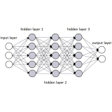
Given the incredible amount of SAR imagery available from different SAR missions, there is a need to develop robust sea ice monitoring strategies using artificial intelligence. We perform a thorough investigation of linear and circular polarized multi-frequency SAR imagery. We investigate SAR backscatter intensity, polarimetric and texture parameters for different sea ice applications. This endeavour focuses on a different combination of polarization (i.e., linear vs circular) and frequencies (e.g., C-band vs L-band) in deep-learning models, for example, to achieve optimal ice-type classification performance during different seasons and ice conditions.

Workshop in North
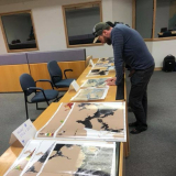
Most ice service agencies, including the Canadian Ice Service, use the World Meteorological Organisation (WMO) Egg code for ice chart preparation. Given the design and substantial information in the complex egg code, these codes are not user-friendly for northern communities. We aim to design a user-friendly ice chart with information the community user identifies. Through community consultations, we explore how to represent them on paper and/or web maps. We aim to pioneer this effort in selected northern communities to grasp this critical subject matter. While doing this, we also plan to disseminate relevant sea ice information per community need through indigenous social media platforms, such as
SIKU.


