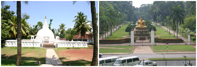
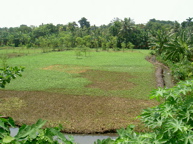
Colombo is a port city built by the colonial rulers who ruled parts of Sri Lanka from 1505 to 1948. The colonial rulers had given more emphasis to develop the port related infrastructure to support their trading activities compared to civic needs. The city is bounded by a river on the north and by the sea on the west. The south and east boundaries are adjoining two municipalities. The city is located on a generally flat terrain which has an elevation of 0 to 10 meters mean sea level. The northern part of the city is on a relatively high elevation where residential quarters of colonial rulers were first built. This area is currently a congested low and middle income area. The central business district is located in and around the Port of Colombo and towards the southern direction.
High income areas are located towards south east direction while low income communities are located on the east and northern periphery of the city. Average population density as per 2001 census was 172 persons per/ha. The population living in underserved settlements accounts for about 50% of the city population. However, it was revealed that around 70% of the urban poor have been benefited by the improvement programmes implemented by the government and the municipality during the past 30 year period. Therefore, the so called poor represent well below 30% of the city population at present.
Of the total housing stock about one half belongs to middle and high income while the balance half belongs to low income population. The low income housing stock has been subdivided into several categories depending on the nature of the structure. According to a city wide survey of low income resettlements carried out by the Ministry of Urban Development & Housing in 1998/99 the following sub categories of low income settlements were identified.
| Category | Housing Units |
|---|---|
| Slums | 25,000 |
| Shanties (squatter housing) | 13,313 |
| Low cost flats |
|
| Relocated housing | 14,814 |
| Old deteriorated quarters | 2,757 |
| Unplanned permanent dwellings | 870 |
| Total | 66,022 |
Among these low income houses about 70% have been upgraded and or improved under the government led housing improvement programmes implemented in the city since 1978. Among these, the following major programmes have generated significant benefits.
- UNICEF assisted Urban Basic Service Improvement Programme (UBSP) implemented during 1978 to 1986.
- The Slums and Shanty Improvement Programme implemented by the Urban Development Authority from 1978 to 1984.
- The Million Houses Programme implemented by the National Housing Development Authority between 1984 – 1989.
Currently there is no major housing improvement programme implemented by the government or the Municipality. Yet the National Housing Development Authority carries out construction of low rise apartment housing for middle income families in the city while upgrading of low income settlements are carried out on a routine plan. The Colombo Municipal Council implements programmes supported by the German Technical Cooperation and the DFID of UK Government for infrastructure improvement of low income settlements. In addition to these programmes, the Municipal Council has allocated 2.0 Million Sri Lankan Rupees to each Council Member who could invest those funds for improvement of low income communities in the city.
Further, a government supported programme called “Real Estate Exchange Limited (REEL)” under the Ministry of Urban Development & Water Supply is in operation for promoting the concept of high rise living quarters for low income people of Colombo. The REEL programme is aiming at redevelopment of the low income areas by providing permanent housing and social amenities. Yet, about 10% to 20% of the urban poor who are illegal squatter of marginal land will not be included in these programmes and hence need a specific programme to address their issues.
Note: Above information is based on the City Dossier received for Making the Edible Landscape Project. June, 2004.
Colombo Land Use
According to the city’s land use plan prepared by the Urban Development Authority the following land use pattern was identified.
| Land Use | Hectares | % of Total |
|---|---|---|
| Residential | 1,402 Has | 37.60% |
| Commercial | 225 Has | 6.03% |
| Institutional | 411 Has | 11.02% |
| Industrial | 149 Has | 3.99% |
| Cultural | 249 Has | 6.68% |
| Transport and utilities | 983 Has | 26.36% |
| Vacant and non-urban uses | 262 Has | 7.03% |
| Other | 48 Has | 1.28% |
According to the above data, it is clear that a considerable portion of urban land is available as vacant and non-urban uses, part of which can be used for urban agriculture. At the moment green leave cultivation yards are operating within the city that provides green leaves for the city market. In addition to such farm yards, home gardening is a common feature in Colombo where households grow vegetables and fruits within their plots.
Note: Above information is taken from the City Dossier received for Making the Edible Landscape Project. June, 2004.
Examples of Urban Agriculture in Colombo
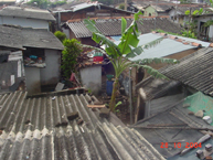 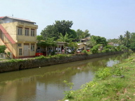 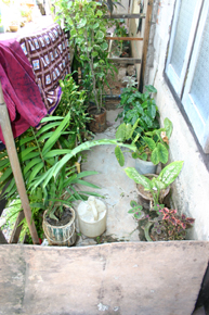 | 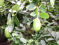 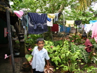 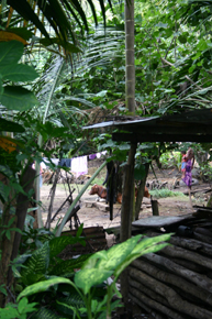 |
